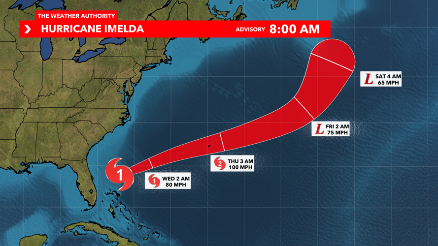

Hurricane Imelda is pulling away from Florida's East Coast and has strengthened into the fourth hurricane of the season as it brings rough surf and high rip currents to the southeast coast of the United States.
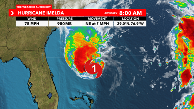
As of the 8 a.m. Tuesday advisory from the National Hurricane Center, Imelda has sustained winds of 75 mph and is moving towards the northeast at 7 mph.
Hazardous marine conditions will persist across the local Atlantic waters as the system departs northwards, with sustained winds 20-30 mph and gusting to 35 mph along Florida's east coast.

Seas are expected to range between 7-10 feet today and 6-9 feet on Wednesday.
High rip current risk is also in effect until 4 a.m. Thursday for the Atlantic coast beaches due to swell caused by Tropical Storm Imelda.
While this hurricane moves away from Florida, it looks to bring tropical impacts to Bermuda over the next few days. A hurricane watch is currently in effect across Bermuda due to the likelihood of hurricane force winds impacting the island from Wednesday into Thursday.
Hurricane Humberto continues to churn in the open Atlantic ocean. As of the 5:00 a.m. Tuesday advisory from the National Hurricane Center, Humberto has sustained winds of 100 mph and is moving north-northwest at 17 mph. Hurricane Humberto will continue to weaken as it avoids land and stays out to sea.
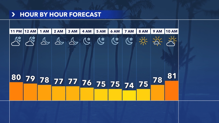
Here in Southwest Florida, we will continue to enjoy mostly sunny skies with winds of 10 to 20 mph and wind gusts up to 25 mph at times. Only isolated showers and storms are possible for Tuesday and Wednesday.
Stick with the Weather Authority both on-air and online as we track these two systems. Tune into our new streaming show, WINK Tracks the Tropics, every weekday at 11 a.m. on Facebook, YouTube and our website for an in-depth breakdown on the tropics.