
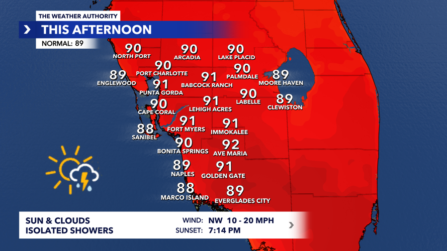


The Weather Authority is tracking a warm and breezy day with a few showers.
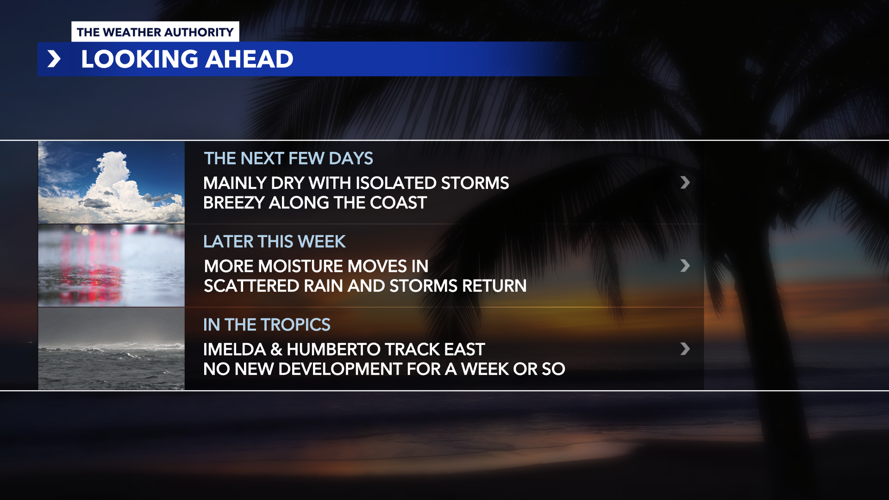
The Weather Authority's Zach Maloch said, "Many dry conditions are still in the forecast, similar to yesterday, with some isolated showers and thunderstorms popping up mainly late in the afternoon and into the early evening."

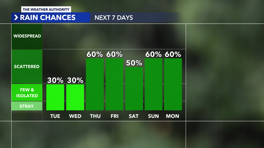
Tuesday

WINK Weather Authority meteorologists are tracking Tropical Storm Imelda as it moves away from Florida's east coast this Tuesday.
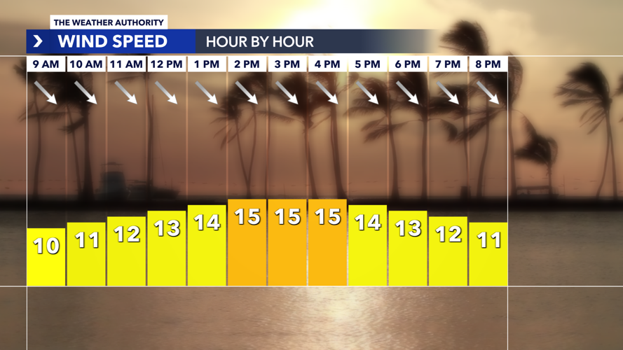
Breezy conditions and isolated showers (30% coverage) will be with us throughout the afternoon and evening.
Highs top out in the lower 90s.
Wednesday
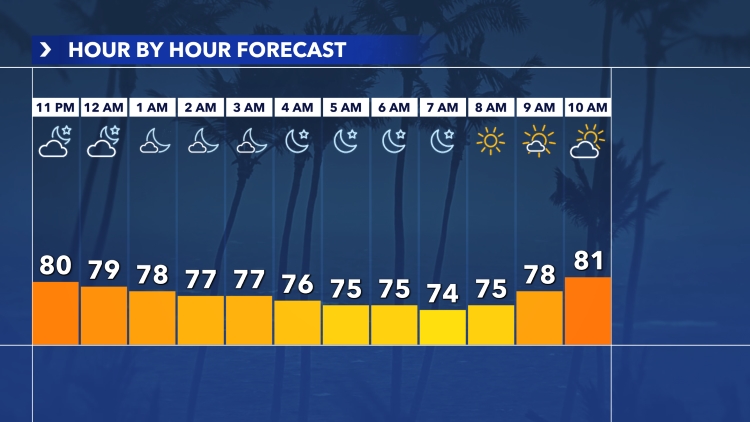
Pleasant start for your Wednesday morning commute with mainly dry conditions in the forecast.
Breezy conditions are once again likely along the coast, with isolated showers (30% coverage) throughout the afternoon.
Highs climb into the upper 80s to lower 90s.
Thursday
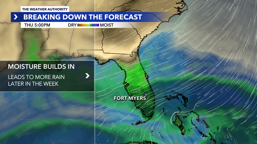
Tropical moisture is looking to make a return to Southwest Florida on Thursday, and this will increase rain chances for your Thursday plans.
Scattered rain and storms (60% coverage) are looking likely through the afternoon and evening.
Highs will be cooler and in the mid to upper 80s.
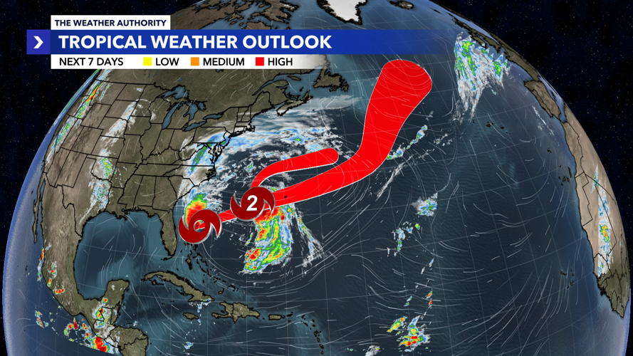
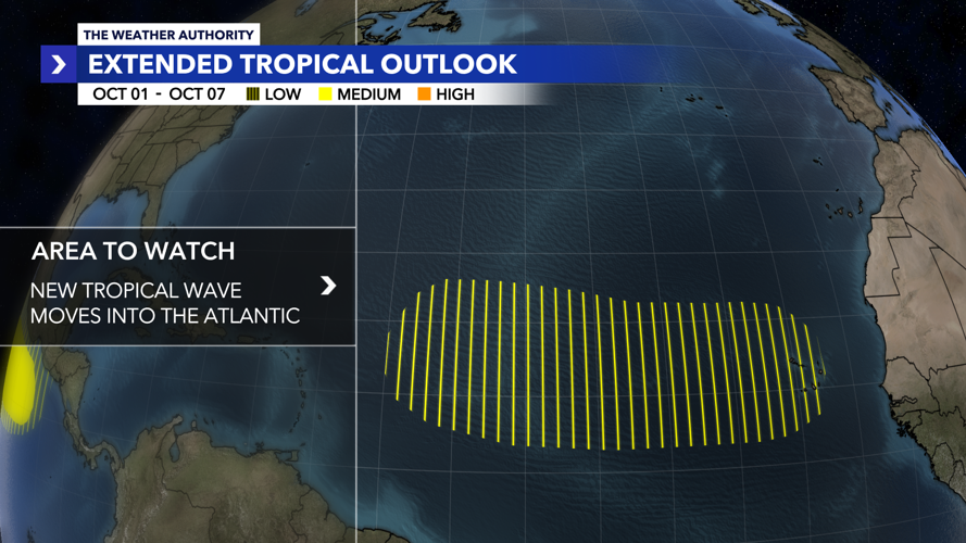
Tropics Update

WINK Weather Authority meteorologists are tracking Tropical Storm Imelda and Hurricane Humberto in the Atlantic.
Hurricane Humberto
As of 5 a.m., Humberto has weakened slightly and is now a Category 2 storm as it tracks north-northwest at 17 mph.
Humberto is forecast to continue weakening as it passes west of Bermuda over day or so.
From there, Humberto is forecast to become post-tropical and dissipate early Thursday morning northeast of Bermuda.
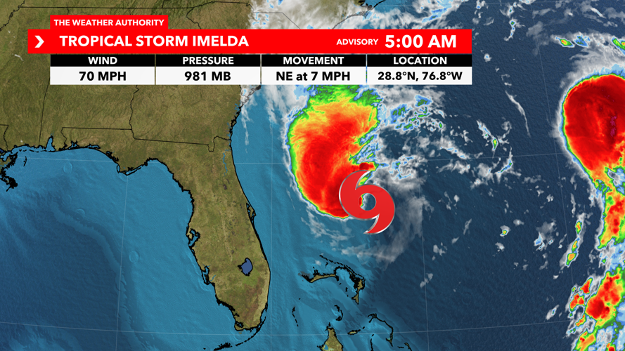
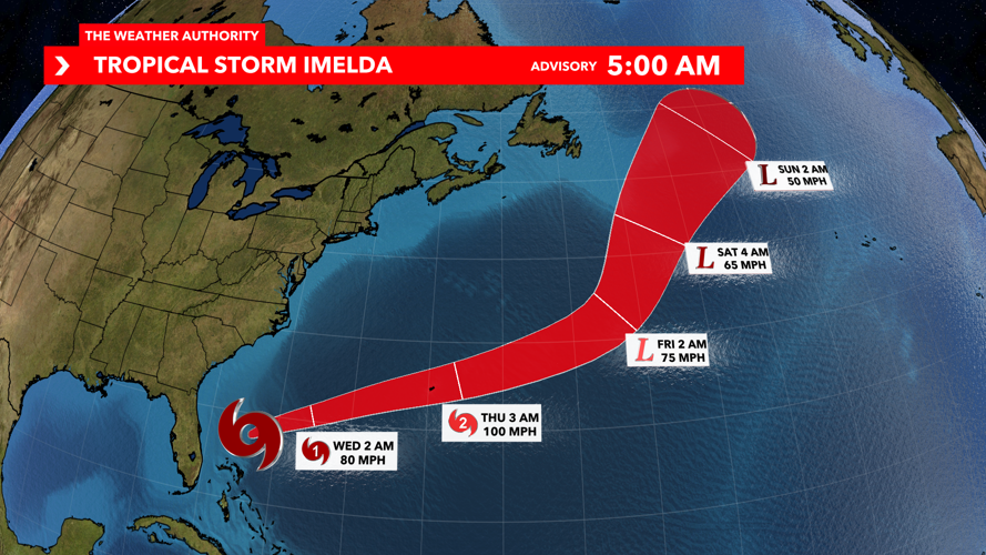
Tropical Storm Imelda
As of 5 a.m., Tropical Storm Imelda is strengthening off Florida's east coast with winds now at 70 mph.

Imelda is now moving more to the northeast as it tracks east of the state at 7 mph.
Hazardous marine conditions will persist across the local Atlantic waters as the system departs northwards, with sustained winds 20-30 mph and gusting to 35 mph along Florida's east coast.
Seas are expected to range between 7-10 feet today and 6-9 feet on Wednesday.

High rip current risk is also in effect until 4 a.m. Thursday for the Atlantic coast beaches due to swell caused by Tropical Storm Imelda.
Tropical Storm Imelda is forecast to strengthen into our 4th hurricane of the season later on in the day.
While this area moves away from Florida, it looks to bring tropical impacts to Bermuda over the next few days.

A hurricane watch is currently in effect across Bermuda due to the likelihood of hurricane force winds impacting the island from Wednesday into Thursday.