


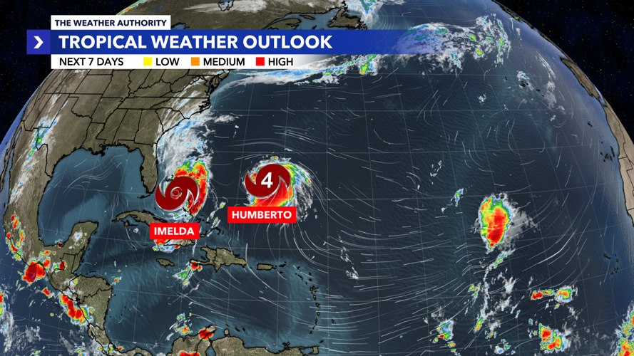


WINK Weather Authority meteorologists are tracking Tropical Storm Imelda and Hurricane Humberto in the Atlantic.
Hurricane Humberto

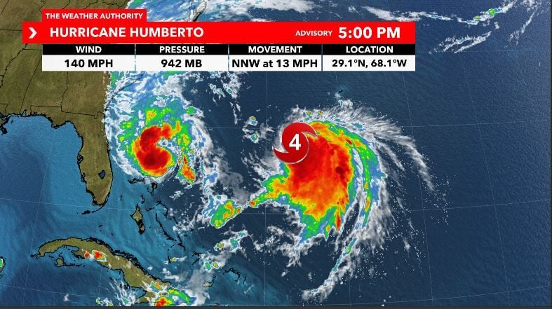
As of 5 p.m., Humberto continues to be a strong major hurricane with speeds at 140 mph as it tracks north-northwest at 13 mph.
While Humberto is forecast to remain strong over the next few days, it is also forecast to weaken as it passes west of Bermuda and tracks into the northern Atlantic.

As we've mentioned since last week, Humberto poses no threat for us here in Southwest Florida and is forecast to move away from the United States.
Tropical Storm Imelda
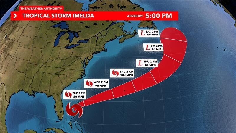
As of 8 p.m., Tropical Storm Imelda remains over the Bahamas, with sustained winds of 65 mph, moving north at 9 mph.

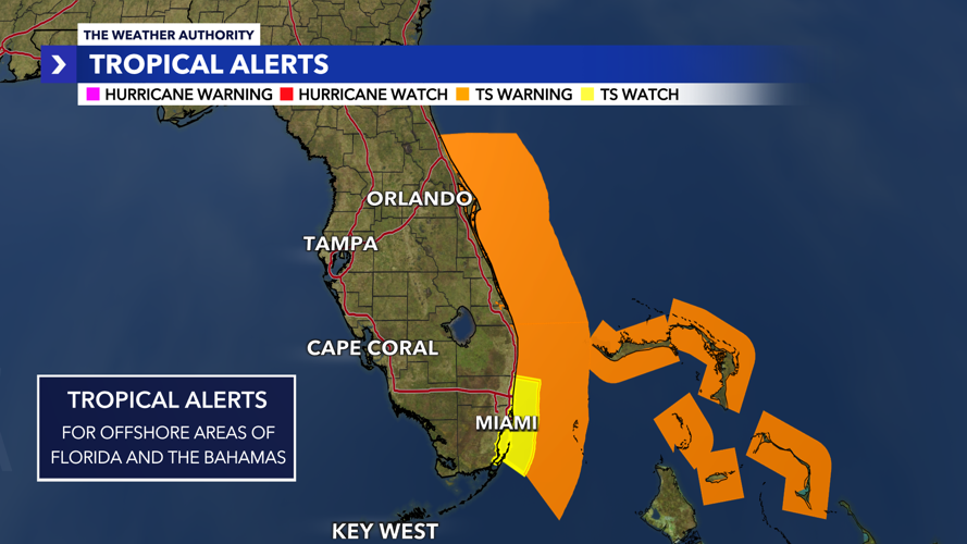
There remain no active tropical watches or warnings for land areas of South Florida.
Tropical Storm Warnings remain in effect for the outer Atlantic waters and nearshore Palm Beach waters through 8 p.m. this evening.

This will transition to a Small Craft Advisory tonight as wave heights surge due to swell from Imelda. Elevated winds and seas in the offshore Atlantic waters are likely through at least mid-week, along with a high risk for rip currents for all Atlantic beaches.
Tropical Storm Imelda is forecast to turn to the east over the next 24 to 36 hours and strengthen into our 4th hurricane of the season.
While this area poses minimal impacts for Florida, it may bring more impacts to Bermuda midweek.


