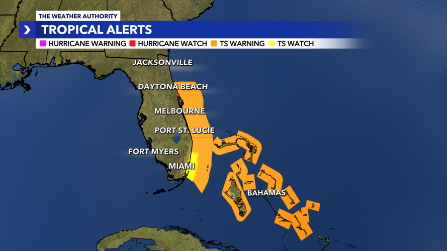


Tropical storm warnings are in place across the Bahamas and offshore Florida’s east coast as Tropical Storm Imelda strengthens.

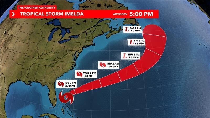
There are no longer any tropical storm watches in place on land for Florida’s east coast. As of the 2:00 p.m. Monday advisory from the National Hurricane Center, Tropical Storm Imelda has sustained winds of 60 mph and is moving towards the north at 9 mph.

Imelda is forecast to become a hurricane by Tuesday as it continues to move northward, staying a safe distance from the state of Florida and paralleling the east coast. While portions of Florida’s east coast could potentially see a few pockets of gusty winds and heavy rain, overall impacts are not concerning. The storm will take a turn back out to sea later this week, sparing the southeast coast from a direct impact. Bermuda will need to monitor this one.
Closer to home here in Southwest Florida, we will see no impacts from Imelda. In fact, Imelda will help to reinforce some drier air aloft on the back side of the storm, limiting our rain chances for the first half of the week. Isolated showers possible on Monday, only a few for Tuesday and Wednesday with plenty of sunshine. It will be a bit breezy at times over the next few days with wind gusts of around 20mph. Boaters should exercise caution due to choppy waters and higher seas.
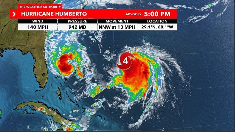
Humberto remains a powerful category four hurricane in the Atlantic. As of the 2:00 p.m. advisory from the National Hurricane Center, Hurricane Humberto has sustained winds of 140 mph and is moving towards the north-northwest at 13 mph. Hurricane Humberto will have no impacts to Florida, and no direct impacts to the United States.


Stick with the Weather Authority both on-air and online as we track these two systems. Tune into our new streaming show, "WINK Tracks the Tropics", every weekday at 11 a.m. on Facebook, YouTube, and our website for an in-depth breakdown on the tropics.


