WINK Weather Authority meteorologists are tracking Hurricane Humberto and Invest 94-L in the Atlantic.
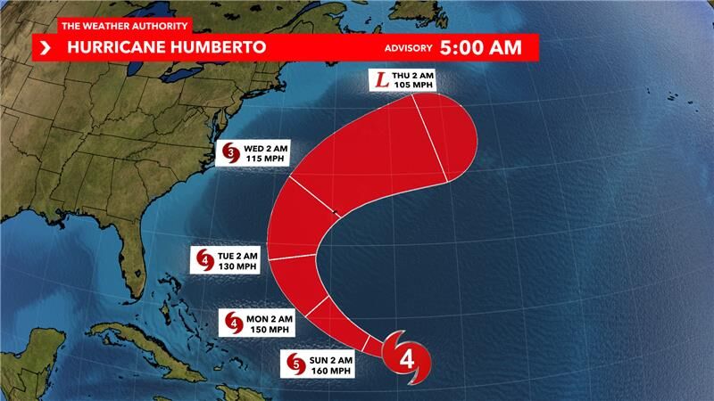
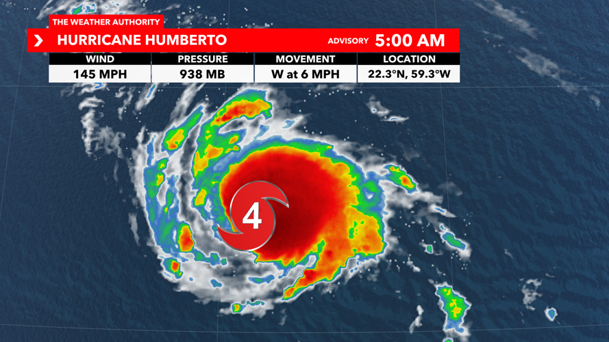
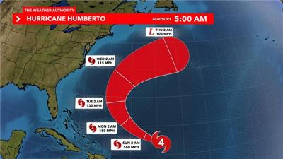
As of 5 a.m., Humberto has strengthened into the 3rd hurricane of the 2025 Atlantic Hurricane Season and is forecast to strengthen into our 3rd major hurricane over the weekend.

Humberto is moving very slowly to the northwest, at 5 mph, and will pick up speed as it interacts with the area of high pressure in the central Atlantic.
Even though Hurricane Humberto is forecast to develop into our next major hurricane, it poses no threat for us here in Southwest Florida as it heads closer to Bermuda early next week.
Southwestern Atlantic (AL94)
Showers and thunderstorms continue to show signs of organization in association with a a tropical wave located near Hispaniola and the Turks and Caicos Islands.
An area of low pressure is expected to form along the wave today when it moves near the southeast Bahamas.
This low is expected to become a tropical depression when it is in the vicinity of the central and northwest Bahamas later today or over the weekend, and then track northwestward or northward over the southwestern Atlantic.
Regardless of development, heavy rains and gusty winds are ongoing in the Dominican Republic, Haiti and the Turks and Caicos Islands and likely to spread across the Bahamas an eastern Cuba during the next couple of days.
Interests in all of these areas should monitor the progress of the system. While there is significant uncertainty in the long-range track and intensity of the system, the chances of wind, rainfall and storm surge impacts for a portion of the southeast U.S. coast during the next several days are increasing.
Formation chance through 48 hours is 80%. Formation chance through the next 7 days is 90%.


