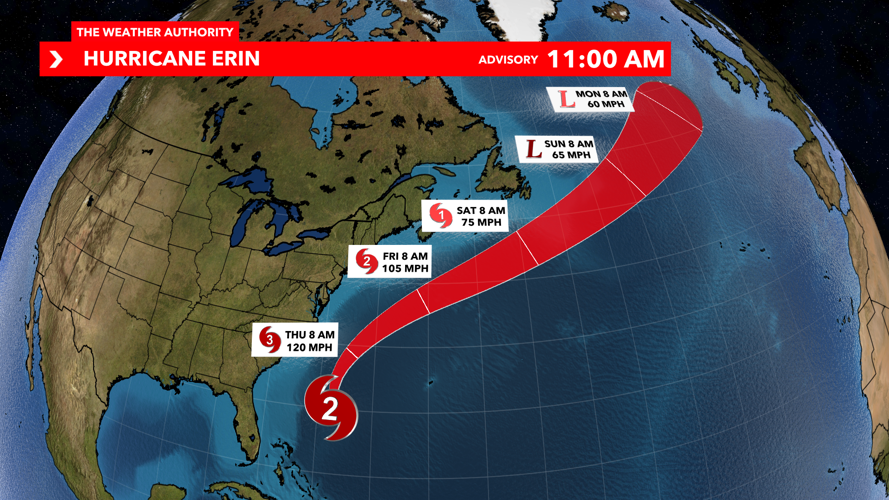
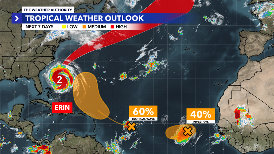
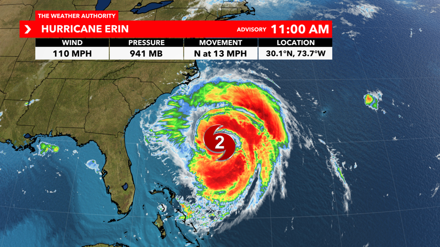

The Weather Authority is continuing its coverage of Hurricane Erin, a Category 2 storm traveling along the Atlantic, and two other areas of interest.
According to the National Hurricane Center’s 11 a.m. Wednesday update: Erin is moving toward the north at 13 mph, with a turn toward the north-northeast expected this afternoon and evening, followed by a faster motion toward the northeast and east-northeast by Thursday and Friday.
While we are not seeing any impacts from Erin here in Southwest Florida, parts of North Carolina and Virginia are under tropical storm and storm surge warnings because of the threat of Erin's winds and storm surge flooding.

Tropical storm warnings have been issued north of North Carolina and from Virginia's border to Chincoteague, Virginia.
Hurricane Erin looks to lift away from North Carolina on Thursday and continue to move quickly away from the United States by the weekend.
A tropical wave over the central tropical Atlantic continues to produce a broad area of disorganized showers and thunderstorms. Environmental conditions appear conducive to the gradual development of this system, and a tropical depression could form late this week or over the weekend while it moves near or to the north of the northern Leeward Islands.
Over the next seven days, the NHC has given a 60% chance of further development.
Eastern Tropical Atlantic (AL99)

Recent satellite-derived wind data indicate that a concentrated area of showers and thunderstorms designated as AL99 is located just southwest of the Cabo Verde Islands and lacks a closed surface circulation.
Environmental conditions appear marginally favorable for additional development over the next day or so, while the system moves westward at around 15 mph.
By the end of the week, environmental conditions are expected to become unfavorable for further development.
Over the next seven days, the NHC has given a 40% chance of further development.


